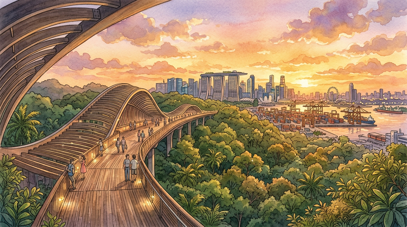
For a Southern Ridges Trail Complete Walking Itinerary: Planning Your Visit, the most efficient route for first-time visitors is a 6–8 km, 3–4 hour walk from HarbourFront (Marang Trail) up to Mount Faber, across Henderson Waves, through Telok Blangah Hill Park and Forest Walk, over Alexandra Arch to HortPark, ending at Canopy Walk and Kent Ridge Park. This itinerary balances iconic viewpoints, shaded walking and easy MRT access while keeping safety, rest stops and exit options in mind—ideal for both leisure walkers and property seekers exploring Singapore’s southern corridor with Homejourney.
How the Southern Ridges Trail Fits into Homejourney’s Broader Singapore Guide
The Southern Ridges is more than just a hiking trail; it is a continuous green corridor that links key residential and employment belts from HarbourFront and Telok Blangah through Alexandra and Kent Ridge. For Homejourney users, this trail offers a practical way to experience the living environment around Mount Faber, Telok Blangah, Pasir Panjang and Science Park, all of which are established housing and business areas. If you are exploring homes nearby via Property Search , walking the Southern Ridges gives a real feel for neighbourhood greenery, hilltop views and connectivity, complementing project data you can find in the Projects Directory . Homejourney’s tourism and lifestyle content, including Southern Ridges Trail: Tickets, Prices & Hours | Homejourney and Homejourney: Best Food Near Southern Ridges Trail for Walkers , helps visitors and potential buyers evaluate both recreation and liveability around these parks.
Essential Information: Southern Ridges Trail at a Glance
Address / General Location
Southern Ridges is a 10 km network of linked parks stretching from HarbourFront (Mount Faber Park) to Kent Ridge Park and Labrador Nature Reserve in southern and southwestern Singapore. Key entry points for this itinerary are HarbourFront MRT (Marang Trail) and Kent Ridge MRT (for ending your walk).
How to Get There (MRT, Bus, Taxi)
- Starting at HarbourFront (recommended for first-timers): Take MRT to HarbourFront Station (North East Line NE1 or Circle Line CC29), use Exit D, and follow signs to Marang Trail. The trailhead is beside the carpark at the base of Mount Faber, clearly signposted.
- Ending at Kent Ridge: From Kent Ridge Park, walk down towards Science Park Drive and Kent Ridge MRT Station (Circle Line CC24) for train connections.
- Alternative exits: Labrador Park MRT (Circle Line CC27) near Labrador Nature Reserve; Alexandra Road bus services for exits near Alexandra Arch and HortPark.
- Taxi/ride-hail: Ask to be dropped at "Marang Trail, at HarbourFront" for the start, or "HortPark" / "Kent Ridge Park carpark" for mid- or end-points.
Opening Hours
The Southern Ridges parks and connectors are generally open 24 hours daily, but lighting and staffing are limited late at night. For safety, Homejourney recommends visiting between 7:00 am and 7:00 pm and avoiding isolated sections after dark, especially if walking alone.
Admission Fees
Access to Southern Ridges—including Marang Trail, Mount Faber Park, Henderson Waves, Telok Blangah Hill Park, Alexandra Arch, Forest Walk, HortPark, Canopy Walk and Kent Ridge Park—is free of charge for all ages. There are no ticketed gates for the basic trail; separate attractions like cable car rides from Faber Peak have separate fees, which are outside this walking-only guide.
Best Time to Visit How Long to Spend Official Website / References This itinerary assumes you start at HarbourFront (Marang Trail) and end near Kent Ridge Park, covering the classic highlights that first-time visitors should not miss. Distance: ~0.7–1.0 km From HarbourFront MRT Exit D, follow the signs to Marang Trail, a short but steep path through secondary forest leading up to Mount Faber Park. The ascent is mainly stairs and paved paths with good shade, but you will feel the climb, especially in humid weather; take it slow and use handrails where available. At the top, join Faber Walk and continue towards Faber Peak and Faber Point, where you will find viewpoints over Sentosa and the harbour. Photo Opportunities & Insider Tips
Because Singapore is hot and humid year-round, the Southern Ridges trail is best tackled early morning (7:00–9:00 am) or late afternoon (after 5:00 pm)
A typical HarbourFront–HortPark–Kent Ridge route of around 8 km takes 3–4 hours1 h 49 min for brisk walkers.
Official information on individual parks and connectors is available via the National Parks Board (NParks) and the Urban Redevelopment Authority (URA), which planned and built the Southern Ridges project at a cost of S$25.5 million. For verified tourism updates, refer to the Singapore Tourism Board via CNA Property News or Straits Times Housing News for broader city context.
Step-by-Step Southern Ridges Trail Complete Walking Itinerary
Segment 1: HarbourFront to Mount Faber (Marang Trail and Faber Walk)
Estimated Time: 20–30 minutes uphill
Segment 2: Mount Faber to Henderson Waves
Distance: ~1 km
Estimated Time: 20–25 minutes
From Faber Point, continue along the ridge via signposted paths towards Henderson Waves, Singapore’s highest pedestrian bridge at 78 m above ground. The route is predominantly paved, with gentle undulations and occasional stairs; it stays relatively shaded until you reach the exposed timber deck of the bridge. Allow time to explore the unique wave-like structural forms and seating alcoves.
Photo Opportunities & Insider Tips
- Visit Henderson Waves in the early morning for softer light and fewer people, or near sunset for atmospheric photos of the city and Telok Blangah.
- The curved timber "cocoons" along the bridge are popular spots for portrait shots and short breaks.
- From a safety perspective, note that the deck can become slippery after rain; walk carefully and keep children close to the inner side.
Segment 3: Telok Blangah Hill Park – Hilltop Walk and Terrace Garden
Distance: ~1.3–1.5 km
Estimated Time: 30–40 minutes
Crossing Henderson Waves brings you into Telok Blangah Hill Park, where you can follow the Hilltop Walk and visit the Terrace Garden Insider Tips
Segment 4: Alexandra Arch and Forest Walk
Distance: ~1.3 km for Forest Walk, ~0.5 km including Alexandra Arch
Estimated Time: 30–45 minutes
Continue west along the ridge until you reach Alexandra Arch, a striking curved bridge crossing Alexandra Road and connecting to the Forest Walk Safety and Experience Notes
Segment 5: HortPark, Canopy Walk and Kent Ridge Park
Distance: ~2–2.5 km from Alexandra Arch to Kent Ridge Park
Estimated Time: 45–60 minutes
At the western end of Forest Walk, you cross into HortPark, a horticulture-themed park with demonstration gardens, lawns and educational displays. It is flat and relaxed, providing a welcome break after the undulating sections earlier. From HortPark, follow signs to Canopy Walk, a 280 m elevated walkway through forest canopy that leads into Kent Ridge Park End Point Options
Guided Tours, Apps and Navigation Tools
Most visitors navigate Southern Ridges independently using park signboards and map boards placed at key junctions. Guided walks are occasionally organised by NParks or corporate groups, but these change over time and should be verified with official listings. For self-guided navigation, many walkers rely on apps such as AllTrails, Komoot or general map apps to track distance and elevation. Homejourney recommends downloading an offline map or pinning key exits (HarbourFront, Labrador Park, Kent Ridge) before you start, in case mobile reception fluctuates in forested areas.
Practical Tips: What to Wear, Bring and Know
What to Wear
Singapore’s heat can be intense, so dress for a tropical hike rather than a casual mall visit.
- Light, breathable T-shirt or sports top; avoid thick cotton.
- Comfortable walking or running shoes with good grip—parts of Henderson Waves and Forest Walk can be slippery after rain.
- Cap or sunhat, especially if you plan to cross Henderson Waves around midday.
What to Bring
- At least 1–1.5 litres of water per person for a 3–4 hour walk; there are limited water points along the trail.
- Sunscreen and insect repellent—biting insects are not severe but present in forested sections.
- Small umbrella or lightweight rain jacket; showers can appear suddenly.
- Portable battery pack if you plan to use your phone for navigation and photos.
Food and Drink Options
There are no full-service cafes inside most stretches of the trail, but you can find food at either end and nearby residential areas. HarbourFront has large malls with food courts, while Science Park and Alexandra have neighbourhood eateries and coffee shops. For curated suggestions, refer to Homejourney: Best Food Near Southern Ridges Trail for Walkers , which lists local favourites close to Alexandra Arch, HortPark and Telok Blangah.
Restrooms
Public toilets are available at Mount Faber Park (near Faber Peak), Telok Blangah Hill Park, HortPark and Kent Ridge Park. However, distances between them can still be 1–2 km, so plan ahead, especially when walking with children or older family members.
Accessibility
Southern Ridges includes both barrier-free, paved sections (parts of Mount Faber, Telok Blangah Hill Park, HortPark) and stair-heavy or uneven sections (Marang Trail, segments of Forest Walk and Canopy Walk). Visitors with mobility challenges may prefer starting at HortPark and exploring its level gardens and short sections of Canopy Walk, avoiding steep connectors. Always check NParks advisories for temporary closures and maintenance updates.
Money-Saving and Time-Saving Tips
Free Activities
The core Southern Ridges hiking trail is entirely free